Air Surveying and Preparation of Obstacles Maps
| Project: | Air Surveying and Preparation of Obstacles Maps |
| Client: | General Authority of Civil Aviation |
| Location: | KSA |
| Area: | e-TOD Area 1 and Area 4 |
| Services Provided: | Air and Land Surveying |
| Brief Description: | |
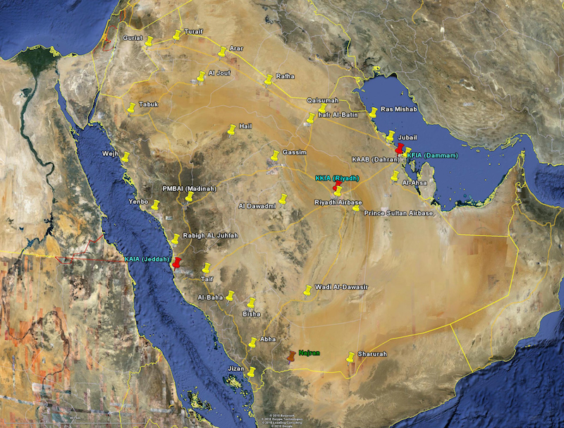
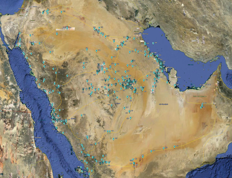
| This project is one of the most important projects ever carried out by GACA for the safety of air traffic. The whole project consists of 4 phases (Area 1, Area 2, Area 3 and Area 4) and no country in whole world has completed the survey for all of the 4 areas. TAPCo has been awarded the contract to complete the first phase which includes the area 1 and area 4. In addition to this, project also includes the survey for more than 600 manmade structures, i.e. buildings, communication towers etc. to get the location and height of the structure. Later on SRTM data has acquired for whole Territory of KSA and vertical accuracy was adjusted with the help of truth points acquired from entire territory to generate Electronic Terrain Obstacle Database for whole kingdom. Our survey team in collaboration with aviation specialist from Egypt has finished the survey work for 22 airports in 22 days and made an international record for this type of survey. With extreme level of safety and security environment, the survey for the runways was carried out. TAPCo survey team is well known of aviation safety rules and regulations and is able to communicate with the control tower in case of any landing or take off. The project scope includes the construction ground control points and geoid undulation survey for 34 International and domestic airports and Area 4 survey for the runways of 3 International Airports. |
|